3.9.2. Rules for adding attributes to vegetation items
The attribute panel for vegetation items looks like this:
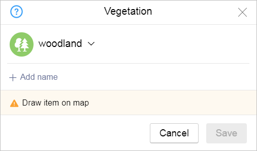
When adding attributes to vegetation items, follow these rules.
3.9.2.1. Type
-
Select the item type from the list:
-
Woodlands:
-
Forests, sparsely wooded areas, and areas occupied by trees and shrubs located outside of localities.
-
Areas occupied by trees and shrubs within parks and squares.
-
Areas occupied by trees and shrubs on vacant lots and within undeveloped blocks (no buildings inside the block, individual buildings located outside areas of vegetation, or
Utility or storage
buildings). -
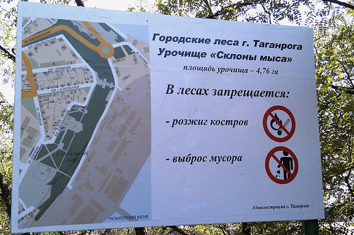
Forest areas with proper names.
-
Terrains that are not drawn in the administrative division layer.
-
-
Park, square — named and unnamed parks, squares, and forest parks.
Note
The outlines of named items either coincide with their associated administrative divisions or are drawn in accordance with the situation in that particular area (for example, they might follow a fence line).
A vegetation polygon may contain other sections of vegetation (such as woodlands or lawns), or it may contain items that exist independently (such as bodies of water, lanes, squares, buildings, etc.). See also point 3.9.1.5.
Draw unnamed parks and squares if they are items with clearly designated territories. For example, if they are bordered by roadways and their layout is highlighted within building blocks.
For this category, don't draw unnamed items that are located inside courtyards and don't have definite borders or are located within a restricted area.
This type also indicates named alleys and avenues that aren't officially recognized as city streets but occupy a defined territory and appear as vegetation items in documents or news sources.
-
Urban vegetation — sections of trees, shrubs, and sod on city blocks with buildings (within localities).
Note
-
Areas of regular development mean areas that are surrounded by streets and that have at least one unabandoned building (this includes private housing).
If an area is not surrounded by roads on one or more sides (for example, it is located on the outskirts of a locality), then its boundaries are taken to be the edges of the private plots or organizations that are located in it.
-
Sections that are completely covered by grass or occupied by trees with detailed representation on the map belong to the
Lawn
type. If a section has bushes or trees (even on its small part) and none of them are drawn on the map, then the section belongs to theUrban vegetation
type.In residential areas with single-family homes, only label the sections of trees and shrubs as urban vegetation (don't include grass vegetation).
If the border of a locality crosses a single area of vegetation (located both inside and outside the border of a suburban residential area or city block), that vegetation area is assigned the
Woodland
type. This type of vegetation area is marked with a red arrow in the drawing: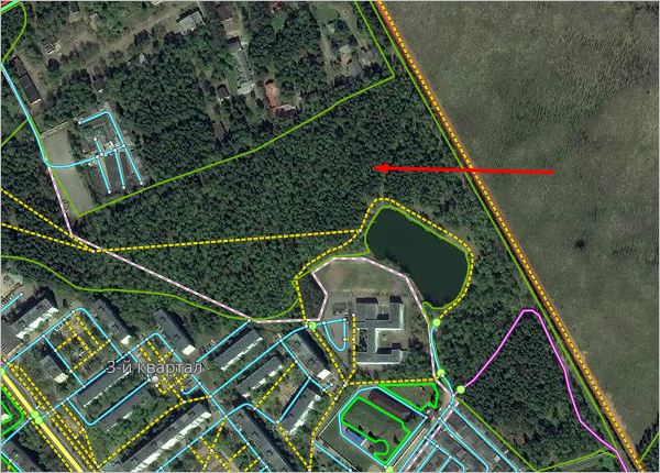
-
-
Nature reserve — protected nature areas of all types: national parks, nature reserves, wildlife sanctuaries.
Note
The item polygon coincides with its administrative division.
A vegetation polygon may contain other sections of vegetation (such as woodlands or lawns), or it may contain items that exist independently of it (such as bodies of water, lanes, squares, buildings, etc.). See also point 3.9.1.5.
-
Lawns — territories with artificial or naturally grown grass that is well maintained:
- Lawns in parks, squares, and other cultural territories (for example, on the territory of the Hermitage Garden).
- Decorative lawns, including athletic fields and flowerbeds.
- Roadside lawns that separate sidewalks from roadways, lawns that separate sidewalks from one another, pedestrians paths.
- Lawns that serve as physical road dividers.
Draw lawns on the territories of localities as well as on the territories of large organizations outside of cities.
-
Garden — territories occupied by industrially planted fruit or decorative trees and shrubs (including vineyards) as well as named territories that are allocated for ongoing plant research and are not recreational areas.
Plants on the territories of individual developments should be assigned to the woodland type
Urban vegetation
.Note
Draw the item polygon based on the physical border of the section containing that type of vegetation. See also point 3.9.1.5.
-
Cemetery — territories that are designated for the burial of the deceased or the internment of their ashes after cremation. This includes official pet cemeteries.
Separate graves and monuments to the dead (such as the tomb of the unknown soldier) are not considered
cemeteries
, but you can draw them on the map as Locations.
-
3.9.2.2. Name
-
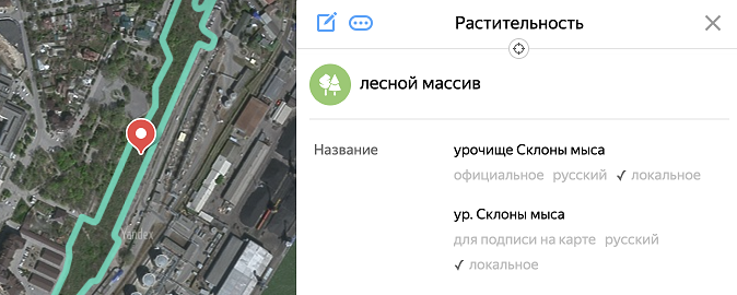
Assign vegetation item names in accordance with the general rules (see 3.1.3. Map item naming rules.
If a vegetation item has a name, you can specify it (except for items of the
lawn
orurban vegetation
types).Examples of names for vegetation items:
- Troyekurovskaya Roscha
- Roscha Imeni Nikiti Shelkovnikova
- Lesopark Serebryany Bor
- Matveyevsky Les
- Vasilyevskiy Les
- Park Pobedy
- Skver Devichyego Polya
- Les Dubrava
- Les Sredny Bor
- Les Zarechny Bor
- Russian Forestry Park
- Solovyinaya Roscha
- Botanichesky Sad Imeni E.Z. Gareyeva.
-
3.9.2.2.1
-
If a cemetery doesn't have an official name but is locally referred to using the name of the closest locality or a religious denomination (as long as that denomination is not the prevailing one in that area), you can use that name as the official name (the short version of the name is preferred). For example:
- Neklinovskoye cemetery
- Staroobryadcheskoye cemetery
If the short version of the name can't be used, specify the full name of the locality. For example:
-
Official: Сemetery of the Grecheskie Roty settlement.
Caption: Grecheskie Roty cemetery.
-
Official: Cemetery of the Vechnost settlement.
Caption: Vechnost cemetery.
3.9.2.2.2
-
For nature reserves, follow these rules when setting the caption name:
-
If an item's proper name is not grammatically related to its type, specify a shortened version of the item's main name as the caption name without specifying the type (omit administrative, technical, and descriptive features that are part of the proper name).
-
If an item's proper name is grammatically related to its type, specify a shortened version of the item's main name and the type as the caption name (omit administrative, technical, and descriptive features that are part of the proper name). For example:
-
Official: Dzhegdyansky nature monument of regional significance to the Magadan region.
-
Name for caption: Dzhegdyansky nature monument.
-
-
If an item's proper name contains the
terrain
type, set a shortened version of the item's main name as the name for caption without specifying the type (omit administrative and technical features that are part of the proper name and shorten descriptive features). -
Sample names for vegetation items:
Official name
Name for caption
Botanical and geological monument Volgino
Volgino
Natural monument of regional significance Aleksandrovskie Stepi and stepped vegetation on Aleksandrovskie Sopki
Alexandrovskiye Stepi
State nature reserve of regional significance Poymennaya Dubrava in Block 86 of the Belozersky forestry
Poymennaya Dubrava
Zapovednoye Urochische Skaly Lapsi
ur. Skaly Lapsi
Natural monument of regional significance Markovskiye Gory
ur. Markovskiye Gory
Natural monument Monakhova Krinitsa
Monakhova Krinitsa
Natural monument Rodnik v Sele Lozovoye
Rodnik v Sele Lozovoye
-
-