2.3.4. Dashcam snapshots
Another source of data for drawing on Yandex Map Editor is dashcam snapshots.
Most of these images are taken on city streets, so they can primarily be used for drawing roads, interchanges, and buildings.
To see dashcam snapshots:
-
Click
 (Images of the area).
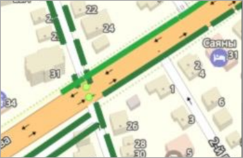
Solid green lines indicate there are pedestrian or automobile tracks at the road section.
Depending on when the photo was taken (less than one month ago, from one month to one year, or earlier), three color shades are used:
-
 — Less than one month ago.
 -
 — From one month to one year ago.
 -
 — More than a year ago.
In this mode, you can select snapshots for display — pedestrian or car:
 — pedestrian;
 — Forward view in car.
 — Side view in car.
-
-
When you hold your cursor over a snapshot point, it will appear in a pop-up window next to it:
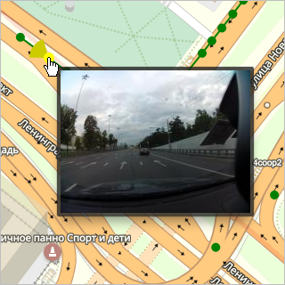
-
If you click the point, the image opens a window:
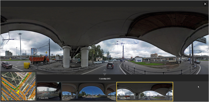
This window includes:
-
A map fragment (in the lower-left corner) where the image displays as a yellow dot and the direction is represented by the yellow "light" that radiates out from it:
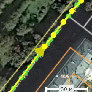
You can select a different image point from that fragment.
The map fragment is displayed in the same snapshot display mode (Tracks or Surface) as the main map.
-
An image (video frame) or series of images (video) made at a given point with the video date indicated.
When you select a particular image (video frame), it will be framed in yellow and enlarged:
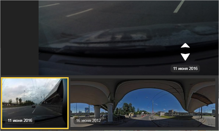
Icons (white arrows) will appear on the enlarged image. Click on them to navigate to the next (
forward
arrow) or previous (backward
arrow) image in the series.When you click through to a different image, the image placemark changes on the map fragment.
You can share a link to a specific snapshot by copying it to the clipboard using the
 button (Copy image URL to clipboard) in the upper-right corner.
-
-
To hide dashcam images, click
(Dashcam snapshots) again.